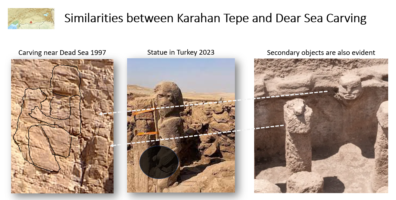
In a visit made in 1997 to the Dead Sea in an attempt to locate the village of Prophet Lot, photos were taken to a statue that is thought to be the wife of Lot and some strange carvings in the rocks that raised more questions than answers.


When presenting those images to family and friends, their immediate response was “this might have been created by nature”, “maybe” or “you think you see things!”, and time passed.
In 2025, I read an article about a statue discovered in Karahan Tepe in Turkey of a man holding his sex organ, that statue immediately reminded me of the carvings in the dead sea, so, in 2025, I decided to make visit, which clarified so many things and paved the way for new discoveries as the technologies and the mindset have improved. But no physical evidence of the town was found.
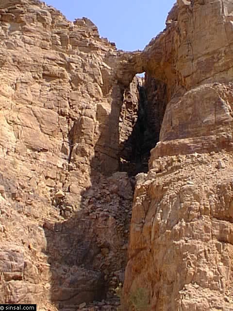
Once again, I searched the Quran for the location, and the Quran was concise “And indeed, it is on a permanent way” (Al-Hijr 76). The word in Arabic is “Sabeel”, linguistically, refers to a road or pathway, but since the Qur’an is a book full of recurring patterns and parallels, the meaning of “sabeel” is explained in Ibn Kathir’s tafsir of Surah An-Nahl – 15: “And thus We made in it paths (subul), meaning roads that people travel from land to land, until He, exalted be He, cuts the mountains so there is a passage between them, referring to ayat 31: ‘And We set in the earth firm mountains lest it should shake with them, and We set in it ravines to serve as ways, that haply so they may be guided;’” – Al-Anbiya 31.
I tried to locate a ravine that cuts through the mountains near the Dead Sea using Google Earth, and there it was, the most obvious and clear ravine around, so beautiful with running water, but there is no town.

Zooming in on the location brought the first surprise, His saying: “Indeed in that are signs for those who discern” means: The آثار (traces/effects) of these punishments are clearly visible upon those lands to anyone who reflects on them and contemplates them with both physical sight and inner insight. — Tafsir Ibn Kathir


It is clear to anyone who observes carefully that there are traces of an unnatural event, not man-made, at the mouth of Wadi Mujib.
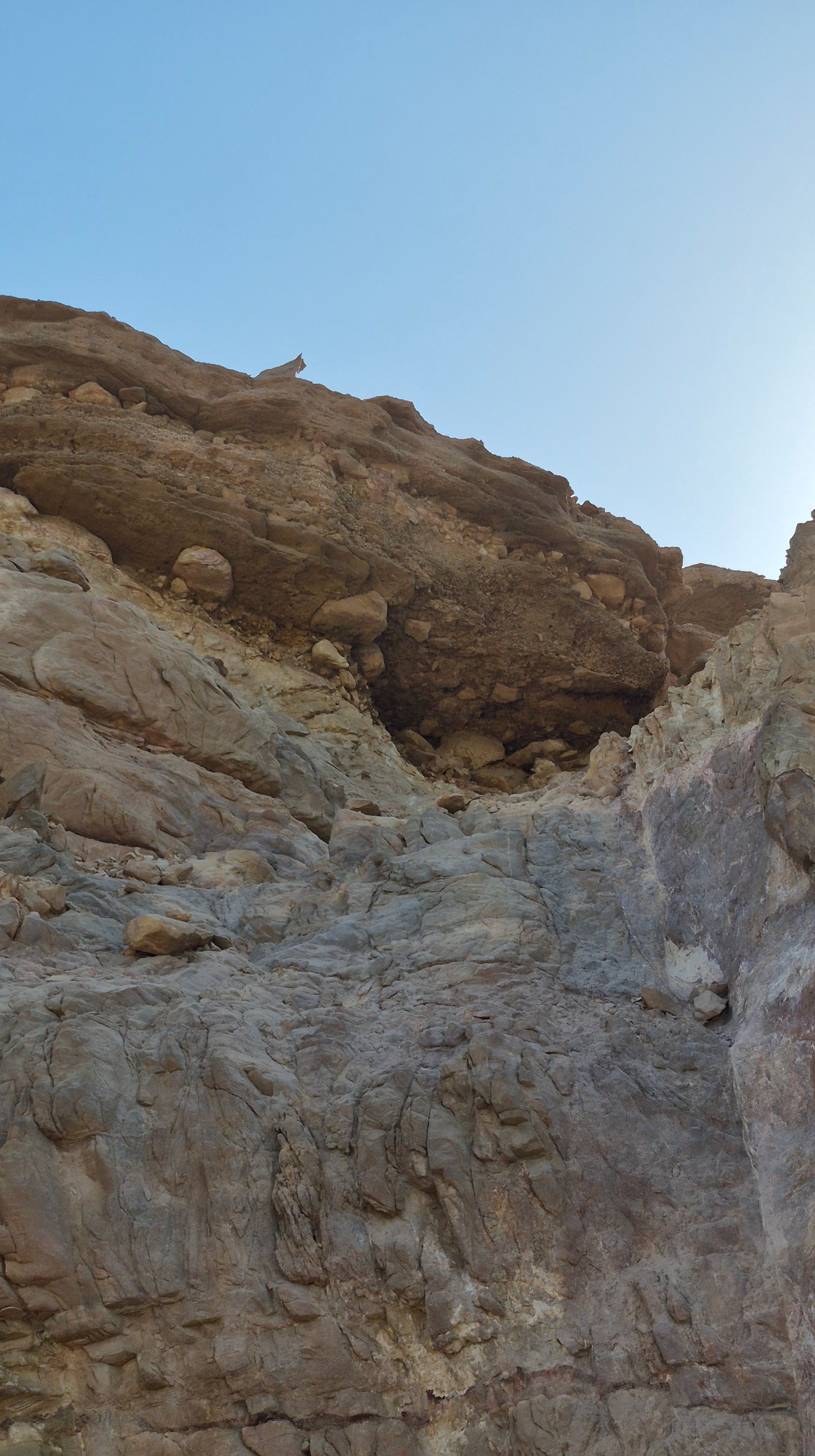
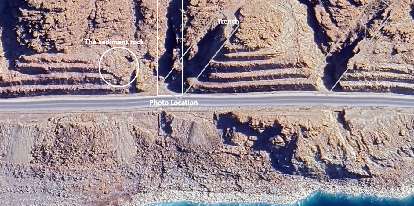
During the 2025 visit, I took a photo of a strange rock formation that attracted my attention,

When I zoomed in on the sedimentary rock in the image above, an extremely striking and perhaps seemingly illogical scene appeared. Firstly, how were these sedimentary layers and smooth stones placed above these hard rocks?
Secondly, in Geological terms, the smooth stone layers should be on top, while sharp stones should be at the bottom. Dark-colored sand layers should be on top because they are exposed to oxidation and natural effects.
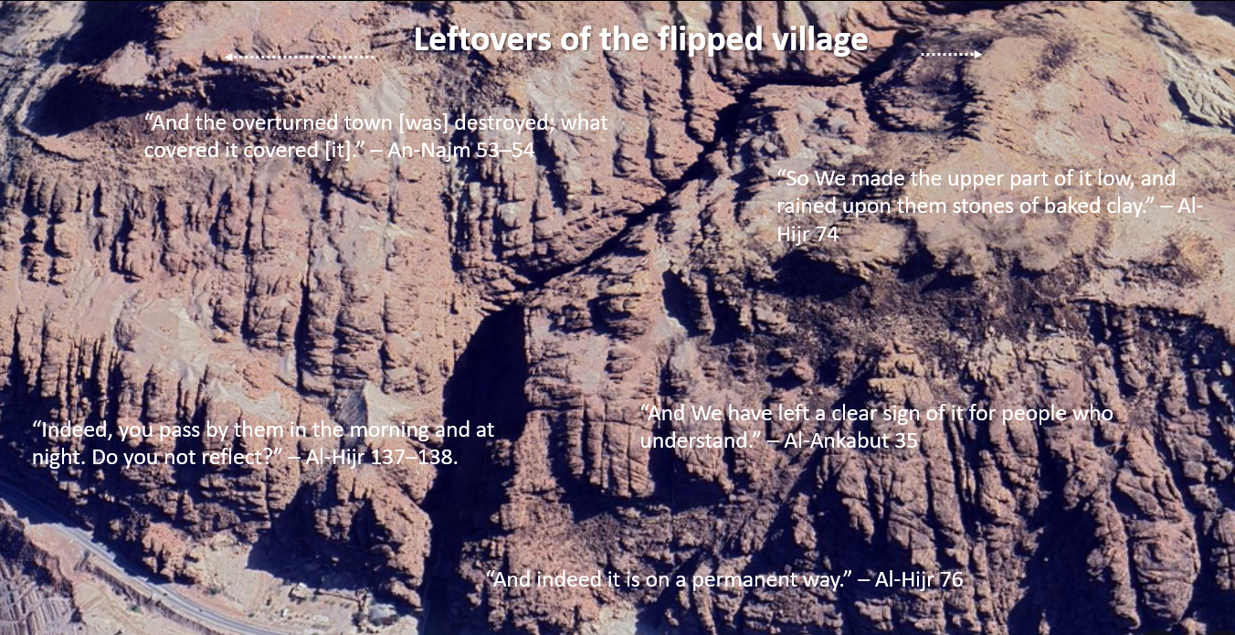
The image shows the opposite. Doesn’t this remind you of Allah’s words: “So We made the upper part of it low”?
This indicates that the village did not fall into the water as imagined, but rather fell onto the opposite side onto the rocks.
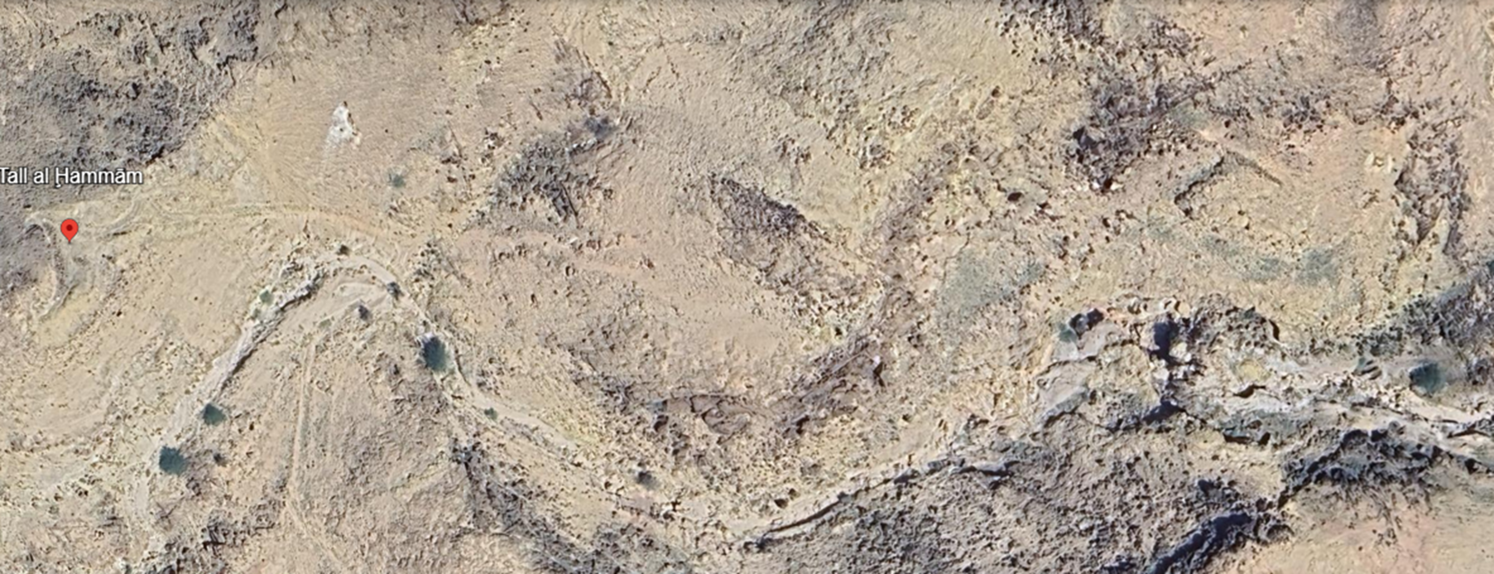
If we look from above using Google Earth, the scene is astonishing. This is a small part of the village remains before our eyes. Due to the impact, precise targeting, and extreme heat, the village was lifted upward and fell inverted onto the opposite rocks.
I have read in the Qur’an about the people of Noah, ‘Ad, Thamud, and Lot, but to see one of these miracles before my eyes, being among the first to witness it, is a blessing and grace from my Lord. The precision of the Qur’an’s description is indescribable; any doubt I had has vanished.
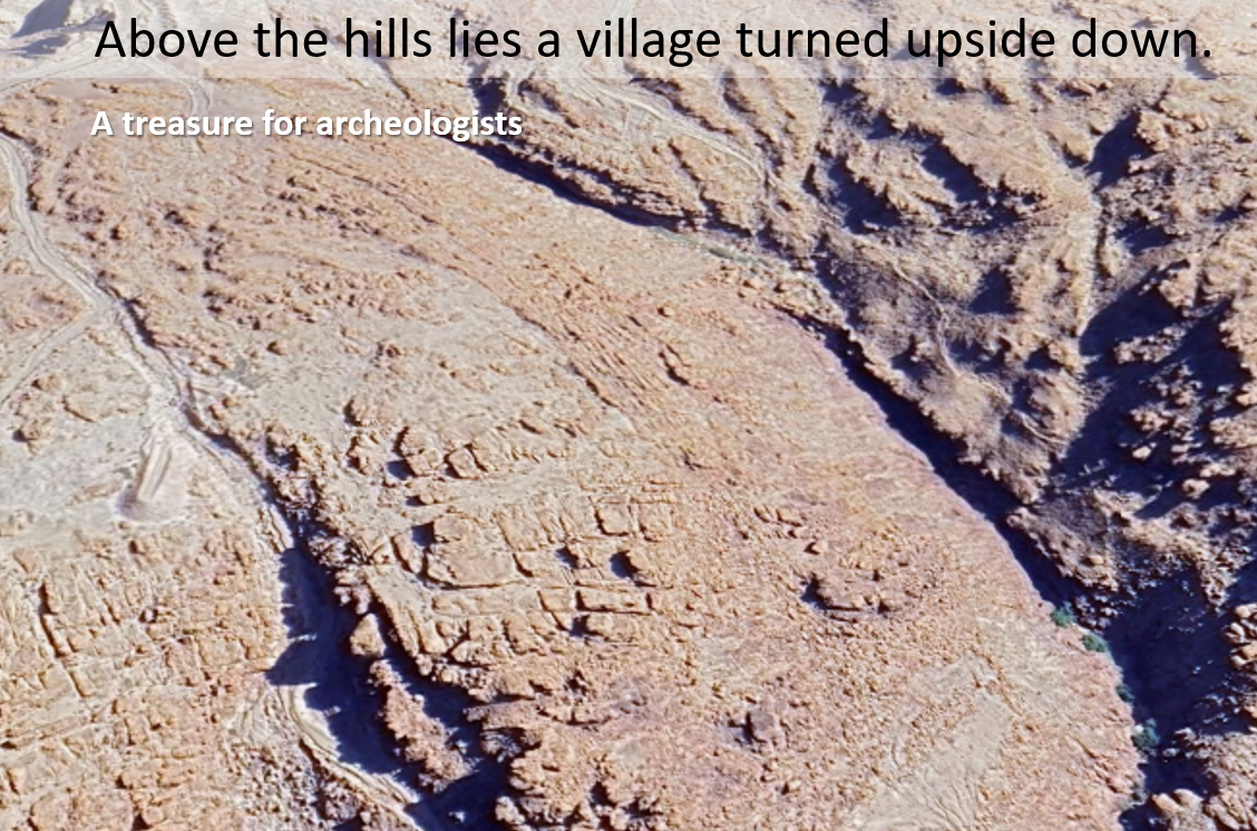
Archaeologists have searched for it everywhere but could not find it, simply because earlier books did not specify its location. The Qur’an, however, identifies its location precisely and describes what happened to it. You can imagine how it was completely uprooted, flew, and fell inverted.


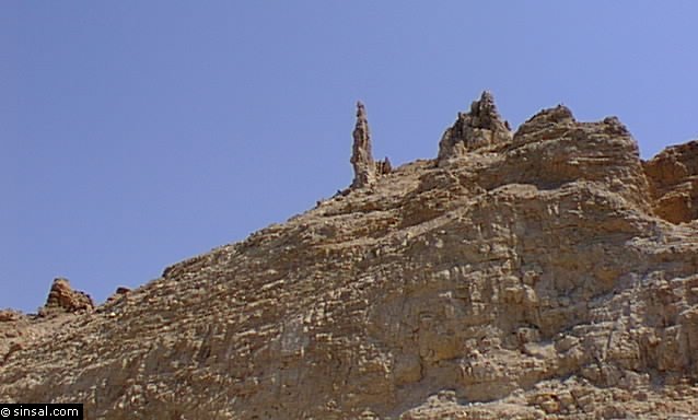
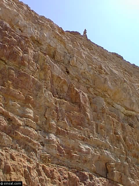
Yes, this is the woman of Prophet Lot. Time stopped for her. She carries a basket in her hand, belongings on her head, and looks wistfully at the sea where her village once stood. Is there anyone who can take heed?
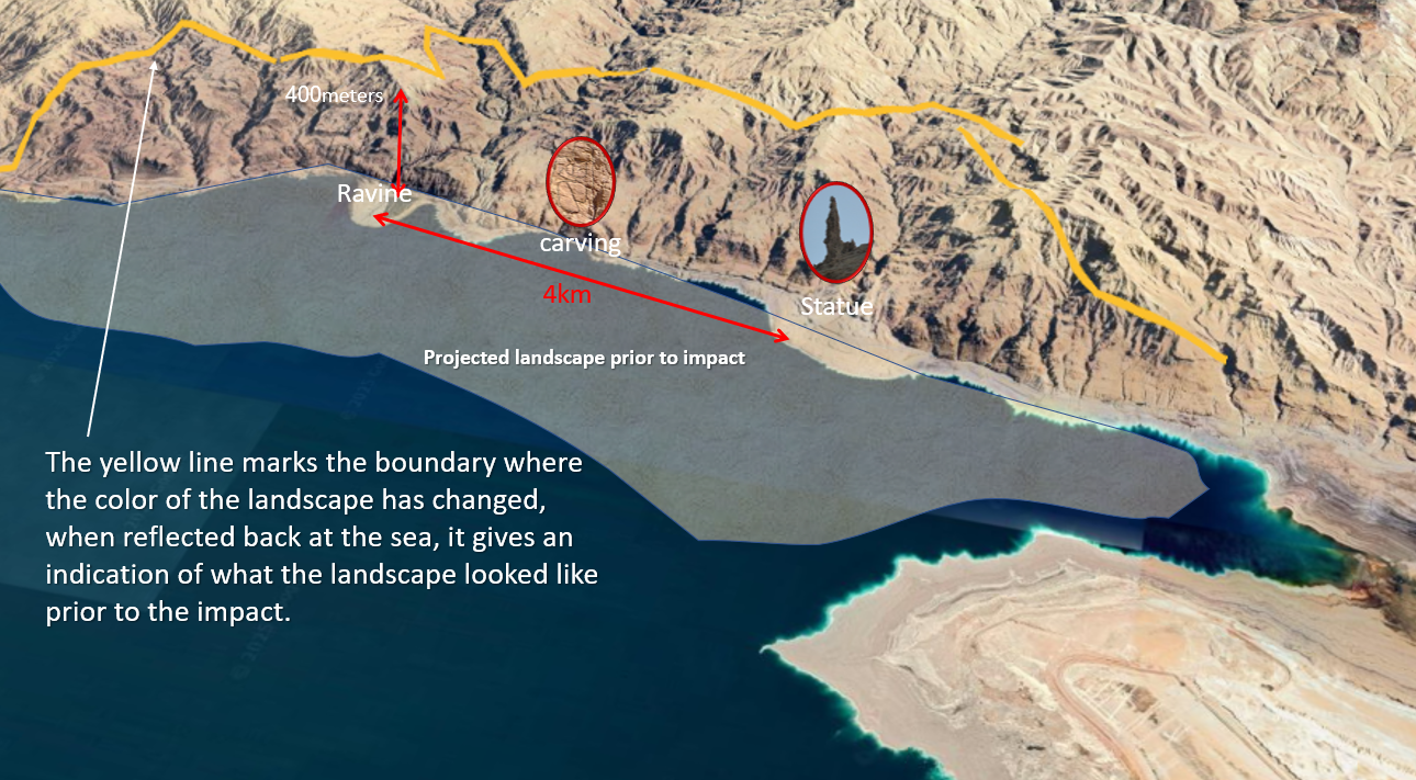
I highlighted in yellow the boundary where the color of the landscape has changed, when reflecting it on the sea, it marked the area of what the landscape looked like prior to the impact.
The scientific explanation is that the area formed over millions of years from accumulated sand, stones, and rocks, creating a sedimentary layer in the area facing the mountains (which I shaded), the area had continuous flow of water, thus, it would have been the ideal place to establish a settlement. What happened next, the Qur’an mentions terms like rajz (punishment) from the sky and kasf (pieces falling from the sky).
Qatadah said: the cities of Lot had four thousand thousand (4 million) people, and the valley was engulfed with something like fire, petroleum, and tar like a furnace’s mouth—a metaphor for extreme heat, intense flame, terrifying to see, like an ignited oven.
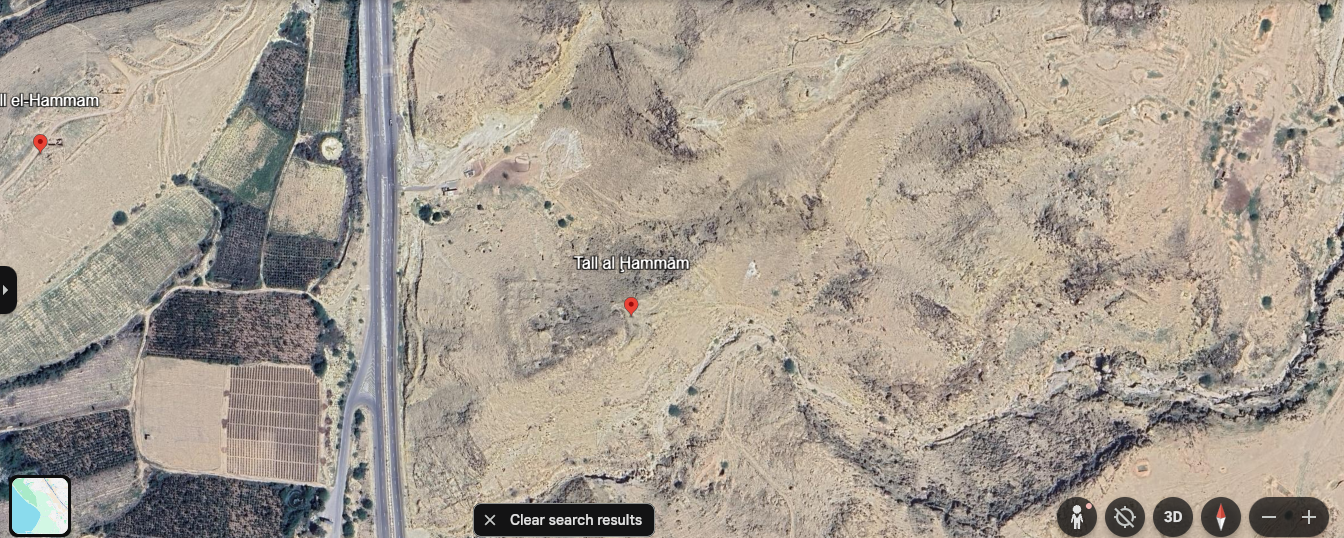
Here, Qatadah refers to multiple towns that shared in wrongdoing and highway robbery. These that remain, the largest being possibly Tall El-Hammam.
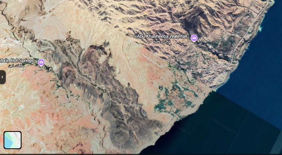
The area between Ma’in Hot Springs and the Dead Sea shows volcanic features with clear craters.
According to geological experts, the Tel al-Hammam was exposed to temperatures estimated at 2,000°C, glazing the rocks. They estimated that the heat source was 4km away.
By: Husein Kattab
